


Gunnison 15, Gunnison County, Colorado
About
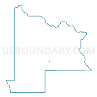
Outline

Summary
| Unique Area Identifier | 548259 |
| Name | Gunnison 15 |
| County | Gunnison County |
| State | Colorado |
| Area (square miles) | 0.22 |
| Land Area (square miles) | 0.22 |
| Water Area (square miles) | 0.00 |
| % of Land Area | 100.00 |
| % of Water Area | 0.00 |
| Latitude of the Internal Point | 38.54722100 |
| Longtitude of the Internal Point | -106.92725040 |
Maps


Graphs
Select a template below for downloading or customizing gragh for Gunnison 15, Gunnison County, Colorado


Neighbors
Neighoring Voting District (by Name) Neighboring Voting District on the Map
- Gunnison 10, Gunnison County, CO
- Gunnison 13, Gunnison County, CO
- Gunnison 14, Gunnison County, CO
- Gunnison 9, Gunnison County, CO